Arboreal Forest
iOS Universel / Economie et entreprise
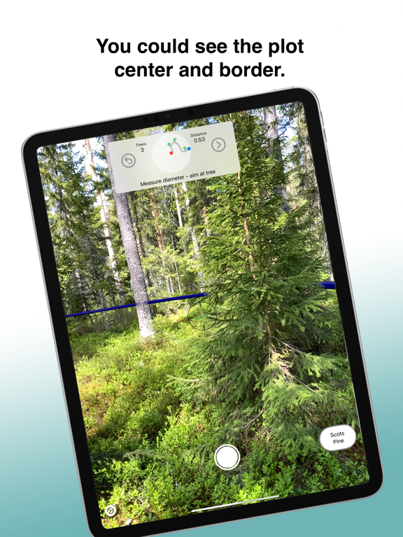
Arboreal Forest — Forest Inventory App
The fastest and most accurate way to measure your forest — straight from your iPhone. No relascope, no extra equipment, no paper forms. Just walk the plot and let the app do the work.
Used by professional foresters, forest engineers, and land managers across Europe. Validated in peer-reviewed research and awarded best mobile app for forest measurements.
Measure everything that matters
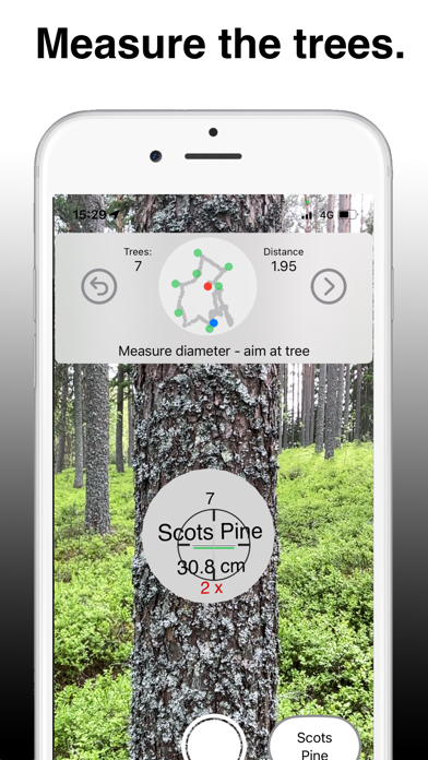
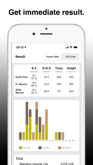
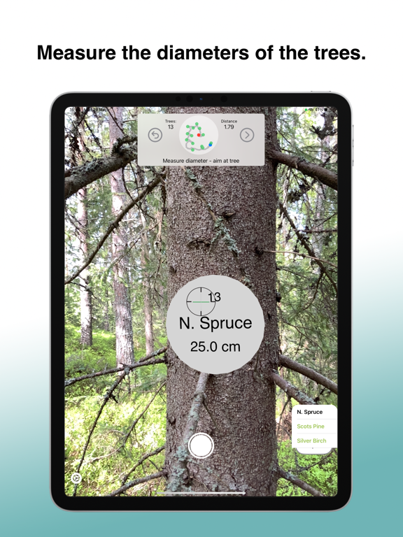
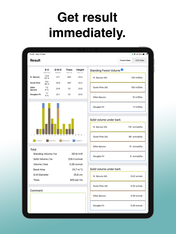
Diameter and basal area
Trees per hectare
Stand volume
Tree height
Tree species
2.5x faster than traditional methods
Arboreal Forest replaces manual tools with AR and LiDAR technology. You get compiled results immediately — no office work needed afterwards.
Sub-centimeter accuracy
Diameter measurements validated against manual measurements in a 2024 scientific study show sub-centimeter accuracy. In a 2023 comparison against competing apps, Arboreal Forest outperformed competitors on diameter and trees per hectare.
Built for real fieldwork
Works offline — no signal needed in the forest
All data synced to the cloud automatically
Export via REST API to your own systems
No reference sticks or additional tools required
Familiar workflow if you have measured sample plots before
Trusted by leading forestry organisations
Sveaskog, Suzano, Forest Design, Treemetrics, Skogshubben, The Navigator Company, and Palos — among others — rely on Arboreal Forest for professional forest inventory.
"We measured the diameter of 10,236 trees and the systematic error was less than 1 mm."
— Guilherme Fonseca, Forest Engineer, Suzano
"The measurements in the forest are much smoother and go faster. I get summary and compiled data to interpret directly in the app."
— Sara Brandén, Area Manager, Sveaskog
Try all features for free
No commitment needed to get started. Subscribe weekly or monthly when you're ready. Your data remains accessible even if you cancel.
Terms of Use (EULA): https://www.apple.com/legal/internet-services/itunes/dev/stdeula/
Quoi de neuf dans la dernière version ?
Bugfixes