Air Map Israel
iOS Universel / Navigation
Air Map Israel is a navigation application for Controlled Visual Flight Regulation as an aid for pilots
Visit us on https://sites.google.com/view/airmap-israel
Terms of Use: https://www.apple.com/legal/internet-services/itunes/dev/stdeula/
Available Features:
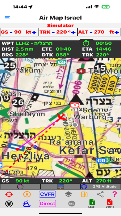
* Show the device location on the map as a plane with its Speed, Direction, Altitude and Geo Information.
Option to add 2,5,10 markers on the plane directional line in distances (nm) or times minutes.
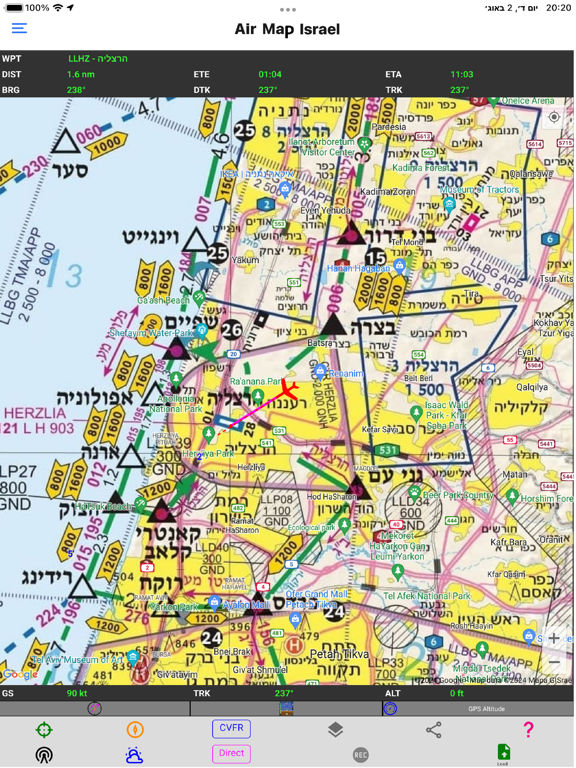
* Tracks the movement on the map with different orientation modes: North Up / Track Up / Off.
* Direct mode - Allow placing a marker by touching the map at any point.
Markers will focus on a nearby known waypoint when possible.
This will calculate in Realtime the:
DIST: distance to the marker in nautical miles.
BRG: Bearing to marker.
ETA: Estimated time of arrival based on current speed.
ETE: Estimated time in route based on current speed.
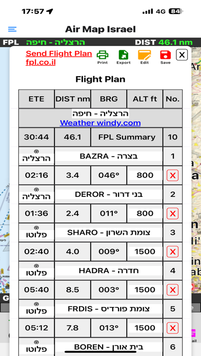
* FPL mode - Flight Plan management mode.
Create new Flight Plan by placing sequential LEG markers on the map.
Markers will focus on a nearby known waypoint when possible.
* Options to Load, Delete, Save, Undo last LEG, Reverse Flight Plan and View the Flight Plan.
* Option to edit existing Flight Plan:
From the details page edit custom names remove leg points and
From the map add middle point and drag a point on the Flight Plan to a different location.
* Option for Flight Plan Auto Tracking, Leg Tracking Alerts and Off Track distance and altitude Alerts.
Including Voice Alerts.
* Fuel Consumption - Allows monitoring the fuel consumption status during flight.
* Weight and Balance - Allows calculation C.G., Moment, fuel endurance and load charts
* Licences and Logbook - Supports Adding Editing Importing Exporting and Printing the pilot licences and logbook entries.
* Flight Recorder - Allows recording and storing flight tracks.
* Options to Load, Delete, Save, and View the Flight Recordings.
This will include Time, Location, Altitude, Heading, Speed, and Distance.
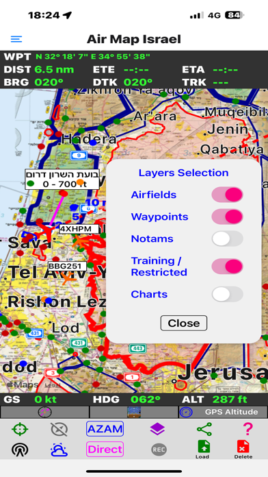
* Adding Layers of Airfields with traffic patterns, Waypoints, Notams, Training & Restricted areas and Charts of airfields.
* Option for Restricted areas Alerts and Training area borders and altitude Alerts, including Voice Alerts.
When Training & Restricted Areas layers are on.
* Option to create and manage custom waypoint on the map.
* Print PDF, Export and Import of Flight Plans, Custom Waypoint and Flight Recording in GPX - GPS Exchange Format.
* Air Map Selection: General Aviation CVFR , Light Sport Aircraft AZAM, Helicopters HEL and IFR ATS Routes Map.
Other Map Selection: RTG nature reserves map, STD standard street map and SAT satellite + street map.
* Altimeter Mode - Option to select GPS / Barometer along with setting QNH.
* EHSI - Electronic GPS based Horizontal Situation Indicator.
* PFD - Primary Flight Display with Attitude Indicator, Direction, Speed, Height, Turn rate and Slip Coordinator.
* Glide mode based on AGL - Above Ground Level info and best glide ratio settings.
* Open Radio common air spaces data.
* Open Weather information ATIS / METAR / TAF of Israel airports for pilots.
* View and Share location with APP users.
* Option to view ADS-B out supported Airplanes on the map (Transponder Mode S) Israel area only.
* Air Map Simulator - Allows simulating a flight from chosen location speed and heading.
* Screen orientation Portrait, Landscape, Auto - design for iPad and tablets.
* Measure distance between points on the map.
* World VFR, IFR charts
Main menu:
* Air Map page.
* Settings page - Map Settings, Flight Plan, Recordings, Alerts and other application settings.
* Weather page.
* Radio Frequencies page.
* Weight and Balance page.
* Pilot Licences page.
* Logbook page.
* Notam page - service and airspace filtering.
* Waypoint page for managing Custom Waypoints.
* Resources page for managing the APP maps charts and other downloaded resources.
* Help page - In APP help, APP Version, check for newer version.
Quoi de neuf dans la dernière version ?
Add Map animations to smoothen map movement.
Fix Notam for Israel.