ARI - Active Route Instrument
iPhone / Navigation
You planned the route. Maybe you built the GPX yourself. Maybe you found the trail on a discovery app, read the reviews, checked it against current closures, and exported the track.
You're now on the trail. Now what — stop and pinch a map every time the trail splits?
ARI is what you use when you're walking. It shows you where you are on the route you already chose, what's coming next, and which way at the junction. That's it.
Load a GPX file from any source. Start walking. Glance at the screen when you need to.
WHEN YOU'D REACH FOR ARI
You're approaching a tricky junction and want to verify which direction to take.
You need an at-a-glance pacing check against the planned route — are you on track for the turnaround, the summit window, the daylight?
You're moving through a stretch where the trail gets ambiguous, and you'd rather glance at a single line than reorient on a full map.
You decided to head back early and want to follow the route back to start, not improvise.
You drifted off-trail and want to know which way back to your route.
WHAT ARI SHOWS YOU
DiTo shows you the general direction to your route when you've drifted off-trail
Named waypoints from your GPX — viewpoints, junctions, springs, summits — surfaced as you approach them
Distance to your next waypoint or destination
Your heading so you know which way you're pointed
Return to Start when you need to head back for whatever reason
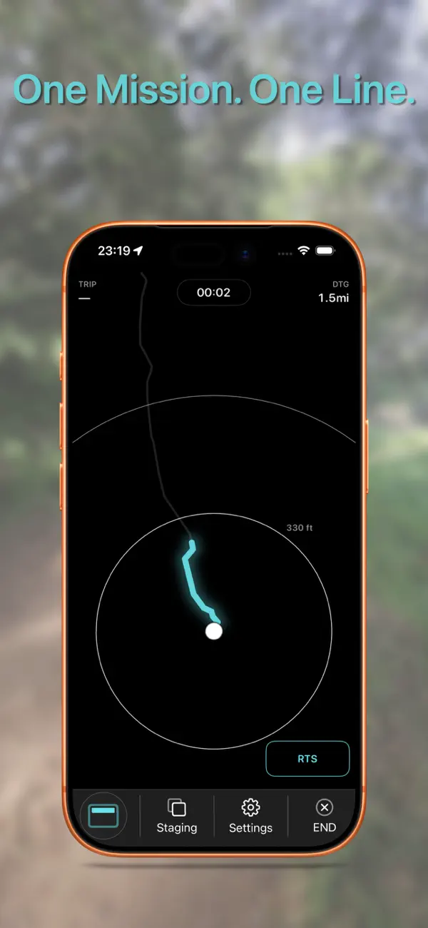
Trip Distance, Elapsed Time, Heading, Current pace, speed, and ETA against your planned route—all at-a-glance
HOW IT WORKS
Plan your route in whatever you use — a route builder, a discovery app, a trail report.
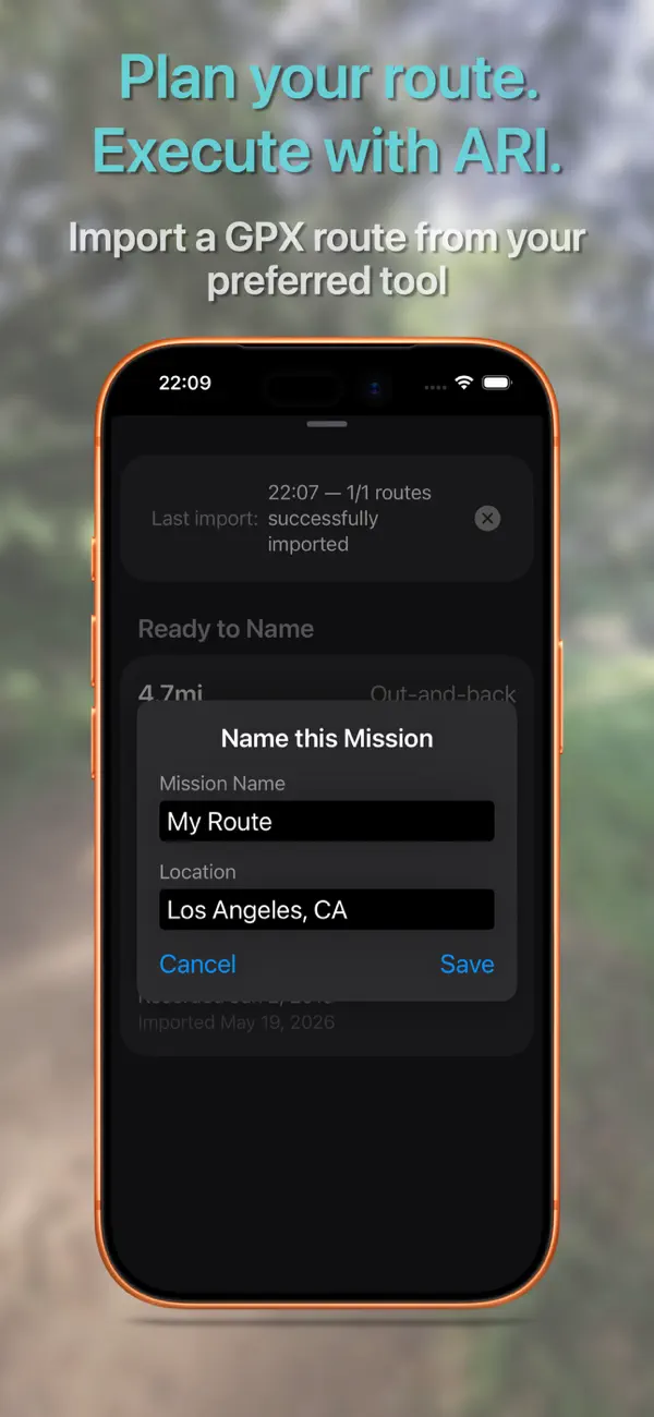
Export the GPX file and open it with ARI.
Give the route a Mission Name. Something to remember it by.
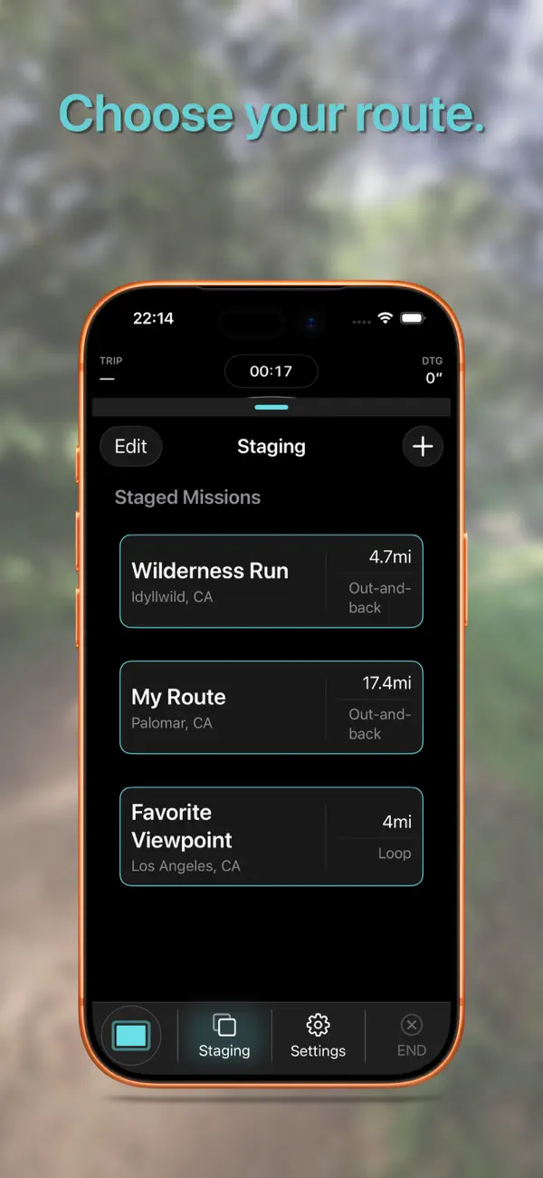
Choose your starting direction. Begin the mission.
Walk. ARI shows the route ahead as a single line. No map clutter.
Approaching the fork or a named waypoint, glance down. ARI confirms which way and what's coming next. Keep moving.
Heading back early? RTS follows your actual route back toward the start — including on loops.
Finish the mission. Drive home. Or arrive back to the camp.
CLOSING
No subscription. No account. No ads.
One purchase. The instrument is yours.
ARI accepts standard GPX files. If you can export it, ARI can run it.
Use ARI as a reference alongside your preparation, awareness, and backup navigation plan. GPS accuracy, terrain, canopy, weather, battery state, and route data can affect what any navigation tool shows.
One mission. One line.
Quoi de neuf dans la dernière version ?
v1.1.0 — Waypoints and improved Return to Start logic
Waypoint surfacing: named waypoints from your GPX route now appear along the mission line, so the viewpoint, the spring, or the junction you marked shows up when it matters.
Improved Return to Start: RTS now handles loop routes more cleanly.
Smaller refinements to HUD readability and confidence indication during transitions.
ARI remains a route instrument. No subscription, no account, no ads.