MapItFast
iOS Universel / Navigation
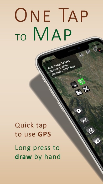
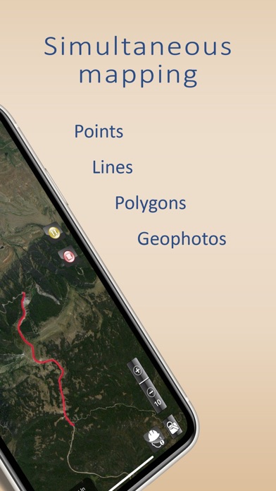
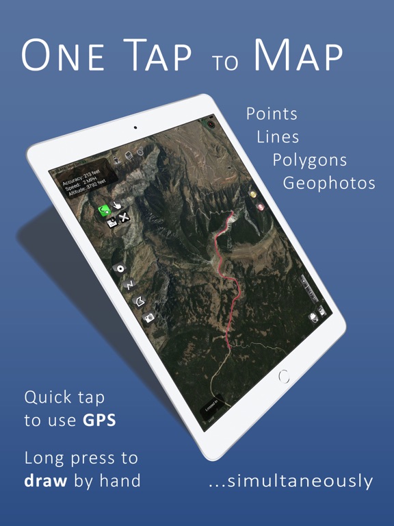
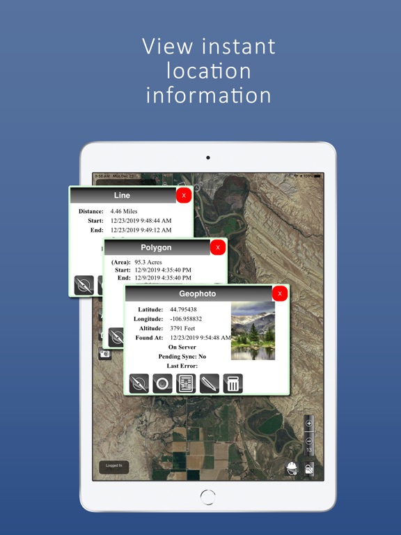
Map points, lines, polygons and geophotos offline with a single tap! MapItFast from AgTerra Technologies is a mapping and data collection solution that makes it easy for users GPS or draw features and generate maps from anywhere with or without internet access. MapItFast instantly calculates location information for mapped objects. GPS coordinates are provided for all points and photos. Lines and polygons include calculated distance and area. Multiple basemaps are included for aerial, street and topo reference. A data connection is not required for mapping.
Note: The free mapping features of MapItFast are available for personal use without creating an account. Registering for a paid account unlocks professional mapping features and links the MapItFast mobile client with your private AgTerra account. The Pro Version extends mapping capabilities to:
- Collaborate with team members, sharing all projects, user locations and contributions in real time on other
mobile devices and the web
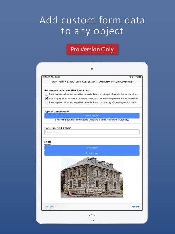
- Design custom electronic forms and attach them to any map object for collecting advanced attribute data
- Create, modify and manage multiple projects and move objects between projects
- Add shapefiles from other sources as a map overlay (include symbology and labeling)
- Add custom data dictionaries to speed and standardize attribution
- Add custom icons to maps
- Export to KMZ, SHP (shapefile) or GPX format for use in other GIS software
- Assign roles and permission based controls for projects and data
MapItFast is appropriate for all spatially based activities including inspections and surveys, agriculture mapping, wildfire and disaster response, utility work, crop scouting, mobile asset tracking, wildlife management, oil and gas fieldwork, forestry, rangeland monitoring, trail mapping, weed and pest projects, and even outdoor recreational activities such as hiking, biking, horseback riding, geocaching, and hunting.
Quoi de neuf dans la dernière version ?
Features & Improvements:
- On project load, MapItFast will zoom to the bounding box of the project
- Clicking on a map object in the search menu will no longer go back to the user's current location after moving to the map object
- Map object modals with pictures now fits the width of the screen on iPhones
- Improved signature widget for forms
- Improved basemap selection menu
- Improved visibility on the map tap toast (shows the tap's coordinates with respect to the map)
- Improved performance when loading projects
Fixes:
- Basemap selections will persist when you close the app and reopen