VT Trails
iPhone / Navigation
VT Trails is built to take you to and from the most scenic vistas in Vermont with style and confidence. This app boasts statewide USGS topographic maps, over 2,000 labeled hiking, walking and biking trails and a high accuracy track of Vermont's Long Trail with 600+ points of interest gathered by through hikers.
Statewide USGS topographic maps are stored on your device, so go ahead and turn on airplane mode to extend battery life and boot up the GPS only when you need it to pinpoint your location.
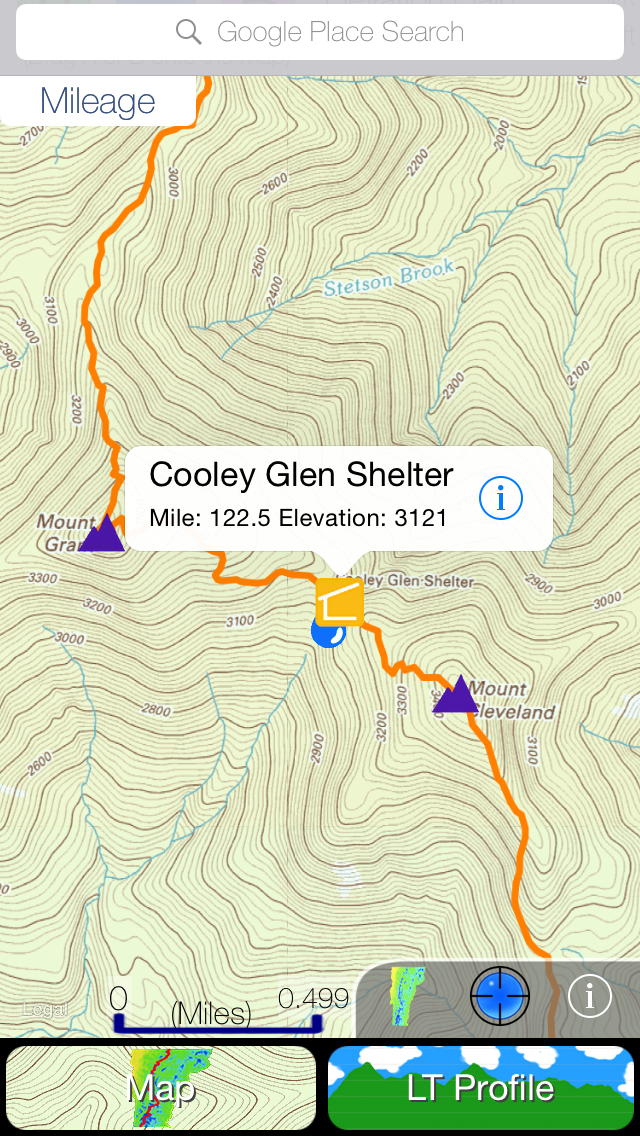
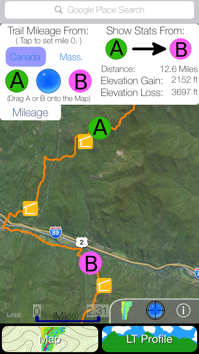
The convenient mileage menu calculates distance between any two points on the map and integrates with an interactive profile graph of the Long Trail to show elevation gain/loss over Vermont’s highest peaks.
Detailed List of Features:
Statewide:
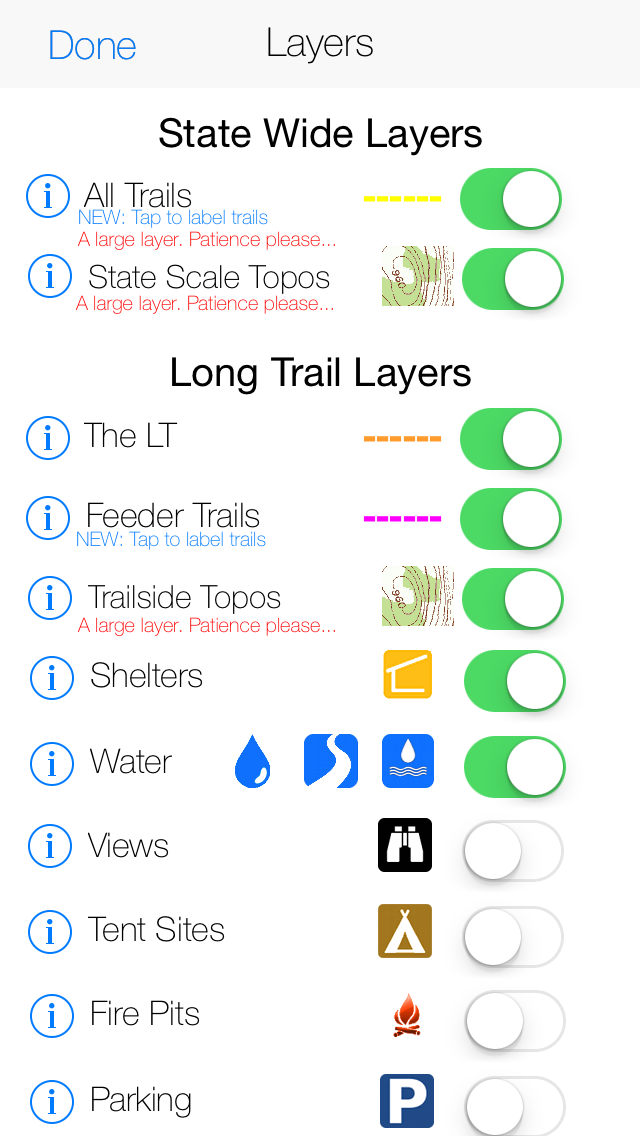
-Statewide USGS topographic maps stored on your phone. No cell coverage needed!
-Over 2,000 labeled hiking, walking and biking trails.
-A mileage calculator for trip planning.
-Place search powered by Google.
Long Trail Focused:
-A highly detailed track of Vermont's longest hiking trail.
-Super high detail USGS topographic maps (1:24,000 scale) flanking the trail.
-A trail mileage and elevation calculator.
-Shelters, official and unofficial, with descriptive photos.
-An interactive profile view showing elevation, trail intersections and points of interest.
-100+ water sources categorized as rivers, streams and ponds.
-Hundreds more waypoints including: tent sights, views, fire pits, parking, summits, towers and gaps.
A selection of over 50 major side trails accessing the LT can be added to the map with the flick of a switch, guiding you with ease to the most scenic locations in Vermont.
Any stream near the LT and big enough to wedge the mouth of your water bottle into has been marked to keep through hikers informed and hydrated.
65 trailside shelters, ski lodges and shacks have been included with descriptive photos and shelters subject to midsummer fees are labeled as such.
Quoi de neuf dans la dernière version ?
This update from Apple will improve the functionality of this app. No new features are included.
-A new look for iOS 8.
-Bug fixes and usability improvements.