Miami Lakes Connect
iPhone / Utilitaires
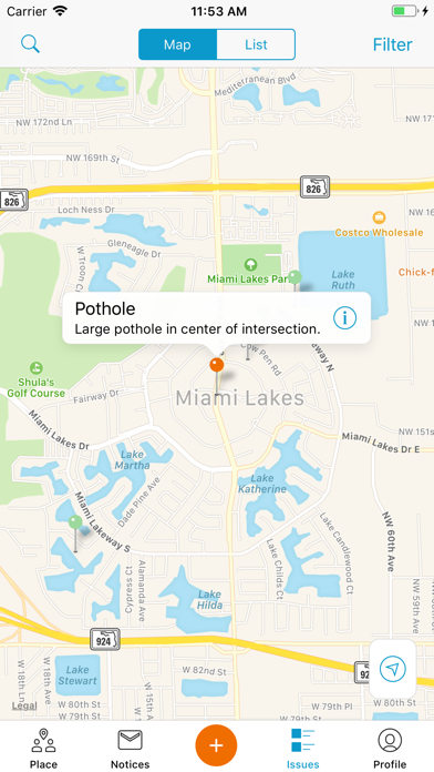
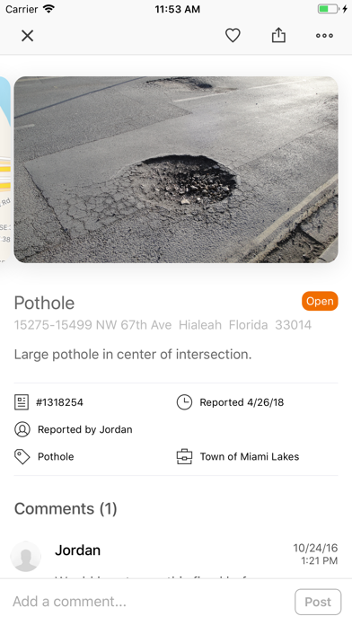
For those potholes, damaged street signs, and other local problems that need attention, the Miami Lakes Connect app makes reporting a problem easier than ever. This app uses GPS to recognize your location and gives you a menu of common quality-of-life conditions to select from. The app allows you to upload pictures or videos to accompany your request. The mobile app can also be used for a variety of other requests as well and then residents can track the status of reports they or other members of the community have submitted.
En voir plus...
Quoi de neuf dans la dernière version ?
- Upgrade iOS version
- Fix inability to scroll request questions when using larger (accessible) font sizes