NATTrack
iOS Universel / Utilitaires
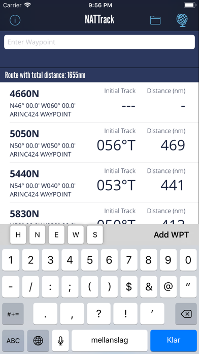
Calculates initial great circle track and distance between given waypoints. Easily add waypoints using common FMC input formats such as 5040N H5040 N50W040 N5030.0W04000.0.
Tracks and distances are calculated for the WGS-84 ellipsoid using the Vicenty Formula.
Displays either true or magnetic track using MAGVAR2015 variation tables.
Worldwide airport database allows easy calculation of track and distance between airports.
Store your own waypoints. Will just take a couple of long nightflights to add all oceanic boundary waypoints to your NATTrack database.
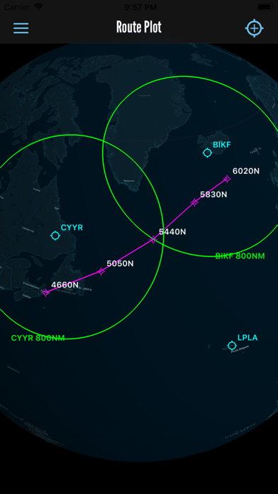
Waypoints will be plotted on a globe chart where also airports and range circles can be depicted.
Quoi de neuf dans la dernière version ?
This update from Apple will improve the functionality of this app. No new features are included.
Now the route will be plotted on a globe chart. Additionally airports and range circles can be plotted on this chart.