Ascend Maps
iOS Universel / Navigation
Ascend is an open source app for vector and raster maps. Features include 3D terrain, offline search, track recording and editing, managing saved places, saving map tiles for offline use, and more.
CUSTOMIZABLE
* Includes a simple, customizable style for OpenStreetMap vector tiles with modes for hiking, biking, and transit.
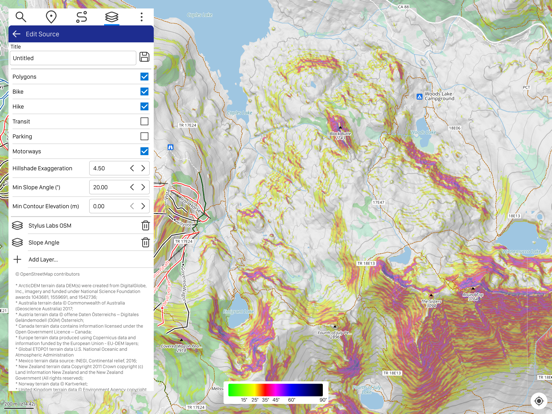
* Overlay customizable hillshading, shaded relief, contour lines, and slope angle shading calculated in real-time over any base map.
* Supports plugins for search, routing, map sources and more.
* Add new online map sources and combine layers to create new maps.
* Generate and import your own vector tiles.
COMPREHENSIVE
* Offline search
* Wikipedia search
* Manage saved places
* Show geotagged photos from your Photo Library.
* Create and edit routes
* Record and edit tracks for hiking, fitness, and more
* Save map tiles for offline use
Learn more at https://github.com/styluslabs/maps
Quoi de neuf dans la dernière version ?
* fixes for running on macOS
* insert waypoints in route
* plugin for hillshading based on actual solar position