WakeWatch
iOS Universel / Navigation
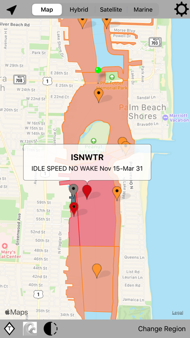
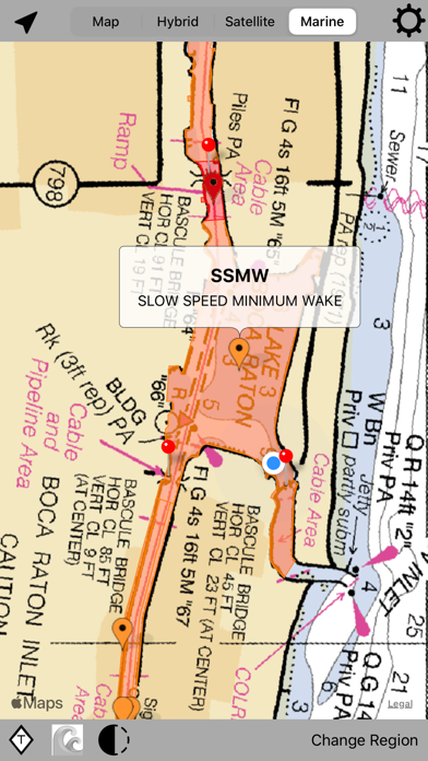
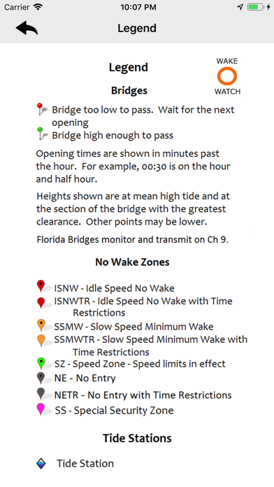
Wake Watch is the Boater's Resource for information on no wake zones, boating speed limits and bridges. We have no wake zone and boating speed limit maps for FL, NC & CT. We have bridge heights and opening schedules for FL, GA, SC, NC, VA & CT. The app uses your GPS location to track your boat on the map to keep you aware of what bridges and no wake zones are coming up on your route. NOAA boating charts can also be used as the base map!
This is a must have for recreational boaters in Florida and snowbirds cruising south for the winter down the ICW. Boating in FL can be frustrating due to no wake zones and limited bridge openings. Limited bridge openings could mean waits of up to an hour or more. This tool will help you to stay informed and plan accordingly.
The app covers all of the waterways in Florida, including the Intracoastal Waterway (ICW), bays, inlets and canals. Also covers key areas such as the Okeechobee Waterway, New River, and more. Includes information from a variety of sources, including NOAA charts, state and federal Manatee Protection Zones, Boating Safety Zones and more. It covers the ICW all the way up to Chesapeake Bay, and all coastal waters and rivers up through VA.
Tide station information was also added. For each tide station, the times for high and low tides each day are shown. Tidal heights are included as well.
NOAA Coastal Waters Forecasts are now included. These include wave height forecasts up to five days out. NOAA Raster Nautical Charts can also be used as the background maps.
Speed and heading data are now included. If your primary GPS/plotter fails, you've got NOAA Charts, speed and heading...Everything you need!
Quoi de neuf dans la dernière version ?
Updated no wake zones were added in Miami, Ft. Lauderdale and Jupiter, FL.