Cartographer
iOS Universel / Productivité
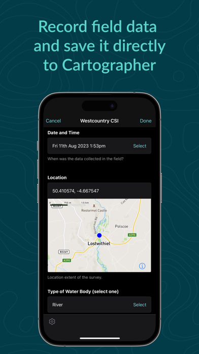
Cartographer helps environmental professionals and volunteers collect geospatial data and upload it to our cloud platform for analysis, publication, and collaboration.
Record surveys in the field, with or without a network connection, and upload them to our servers when you're back on wifi. Browse and share maps of your data from our web site, and export datasets to GIS and spreadsheet apps for analysis.
Please note that use of the app requires a Cartographer user account. Contact our support team or your project coordinator to find out more.
Quoi de neuf dans la dernière version ?
New features:
- Support for Multi-Factor Authentication on the sign-in screen
- Better support for password manager autofill on the sign-in screen
Bug fixes:
- Restored prefetching of form images when installing a project
- Fixed a bug related to copying surveys in multi-team projects
- Saving is now blocked when a survey is approved/rejected or the form contains errors
Updates to survey forms:
- SmartRivers
- RiverWood
- Outfall Safari
- River Guardians
- SAS Water Quality