Directional Drilling
macOS / Education
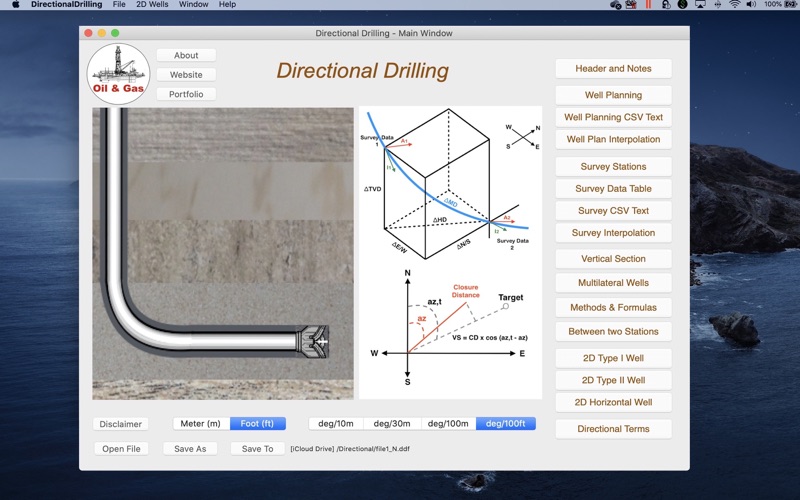
The Directional Drilling Survey provides the control of directional drilling of oil wells with calculations and plotting of well planning and survey data in vertical section, plan view and 3D (x-y-z) view, calculations between two survey stations, easy tools to 2D and 3D wells and plot multilateral wells.
This is an academic project for petroleum engineering.
Please before you buy it, make sure this app will be useful to you. Visit our website and check the "User Guide".
This app was developed based in existing spreadsheets. There is no comparison with any other software.
Our goal was to create a very low-cost application with the help of experts to share with drilling engineers, technicians, drillers, students and teachers of drilling engineering.
There is no intention to replace the professional softwares.
You can contribute with suggestions for improvements, correcting the translation to english, reporting bugs and spreading it to your friends.
Features:
1. Well Planning with Multiple Sections (Minimum Curvature);
2. Ability to work with data files;
3. Directional Survey: Edit, Add, Insert and Remove Survey Data;
4. Calculations Methods:
- Tangential
- Balanced Tangential
- Minimum Curvature (default)
- Radius of Curvature
- Angle Averaging
5. Print Reports;
6. Survey Data Calculations in 5 methods;
7. Formulas of the Methods;
8. Ability to work with length units: foot and meter (metre);
9. Vertical Section View, Plan View and X-Y-Z plotting.
10. Ability to Multilateral wells plotting limited to 6 wells.
11. Easy tool to create 2D Wells (Type I, II and Horizontal).
12. Easy tool to calculate 3D sections on well planning.
13. Sharing data files via email, iCloud Drive, etc.
14. Import Well Planning (MD,Inclination,Azimuth) from CSV text format file;
15. Export Well Planning (MD,Inclination,Azimuth,Quadrant,TVD,HD,VSection,N/S,E/W,DLS,BUR,TRN) to CSV text format file;
16. Import Survey Data from CSV text format file;
17. Export Survey Table to CSV text format file;
18. Sharing data files with iPad, iPhone and iPod Touch via iCloud, iCloud Drive, AirDrop or email;
19. Interpolations in the Well Planning;
20. Interpolations in the Surveys Stations;
21. Ability to get a simulated survey (steps 10m, 30m, 100m or 100ft) from Well Planning interpolations;
22. Ability to resize views and to set fullscreen graphs in high-resolution.
Basic User Guide: Download it from http://www.wellcontrol.com.br
DISCLAIMER:
These tools & materials are provided 'as is' without warranties of any kind, express or implied.
Please verify the tools provided by this application by yourself before you use them. Ensure you understand the impact of using these tools.
Any use you choose to make of these tools & materials is undertaken by you entirely at you own risk.
Quoi de neuf dans la dernière version ?
- improvements in editing 3D interpolation parameters.
- improved importing/exporting directional parameters by CSV Text format:
The well planning and survey stations can also be imported from CSV text files, for example:
"MD","INC","AZI","TVD","N/S","E/W"
"1000.0","0.0","0.0","1000.0","0.0","0.0"
"1100.0","3.0","10.0"
"1200.0","6.0","15.0"
...
The values can be "quoted" or unquoted and separated by:
- Comma: 1.00,2.00,3.00
- Semicolon: 1.00;2.00;3.00 or 1,00;2,00;3,00
- Tab: 1.00 2.00 3.00 (TSV file)
- Space: 1.00 2.00 3.00


