Stereonet3D
macOS / Productivité
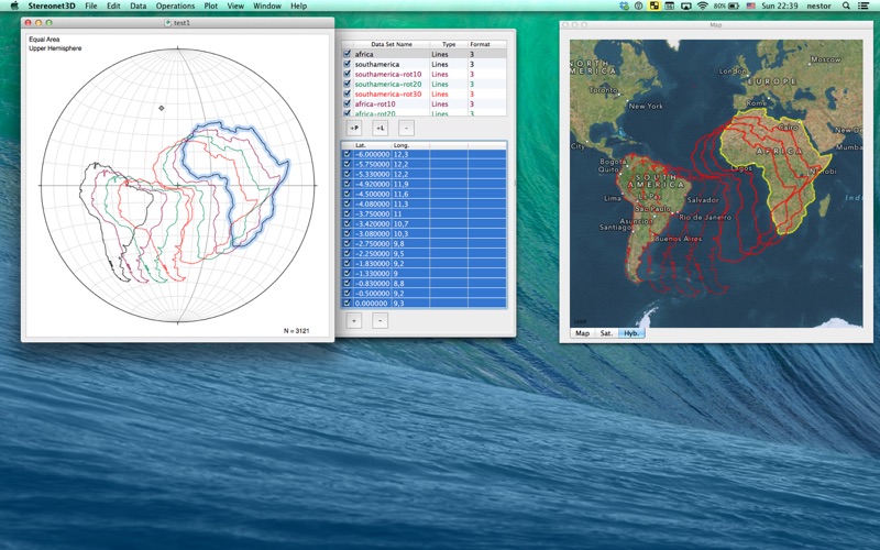
Stereonet3D plots lines, planes and small circles on equal area or equal angle stereonets. The program can also plot the data in 3D, and if the data have lat-long info, on a map/satellite view. Stereonet3D can perform various operations on the data including calculating angles, fixed or variable axes rotations, contouring, statistical and fault slip analyses. Data with lat-long info can be exported to kml. Stereonet3D is a great tool to learn and use stereographic projections.
Quoi de neuf dans la dernière version ?
Significant improvements to the Map view:
1. Add scale bar.
2. Map image produced by drag and drop, contains scale bar and north direction.
3. Symbols have a reasonable size at all scales. A damping factor is added to avoid symbols growing too much with zoom.
4. Annotations are properly placed: In front of the dip tick for planes, and in front of the arrow for lines.