ATSU
iOS Universel / Météo
Flight Planning & Operational Support
• Auto-generated Part A flight planning suggestions
• Detects short and narrow runways, calculates maximum crosswind limits
• Identifies weather-related threats during planning
• Built-in Threat module for enhanced situational awareness
Runway Intelligence
• Detailed wind component analysis (headwind & crosswind)
• Runway slope, elevation, surface type (ASP, CON)
• Runway length, width, displaced threshold data
Airport Essentials
• Airport frequencies and airport maps
• Offline/online note sharing with voting system for pilot feedback
• In-Flight Tools
• Approach path and temperature correction
• Wind component calculator, fuel uplift calculator, logbook summation, unit converters
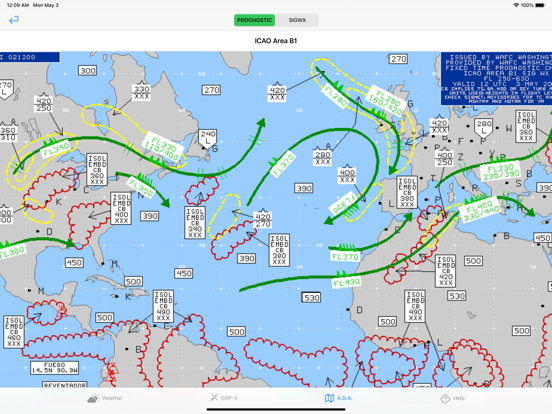
ADA Suite (Airmet Detection & Awareness)
• SIGMET plotting (thunderstorm, icing, turbulence, volcanic ash, and more)
• Great circle flight planner
• Prognostic and significant weather charts
NOTAM & Weather Decoder
• Smart NOTAM classification
• METAR/TAF decoding
• Runway condition/braking action decoder (ICAO and Russian formats)
Meteogram
• Visual meteogram charts showing weather trends and forecasts
Drive Mode
• Listen to latest METARs and TAFs
• Audio mode similar to ATIS
• Designed for hands-free use
Night Time Calculator
• Automatically calculates night flight time
• Based on great circle route
Dangerous Goods Module
• Dangerous goods risk evaluation
• Firefighting and spill procedures
• Drill codes and additional safety considerations
Quoi de neuf dans la dernière version ?
• Refined UI for a cleaner and more intuitive experience
• Offline NOTAM and ATIS access for pilots
• Enhanced note sorting: Upvoted, Newest, Updated
• Database optimizations for better performance and reliability


