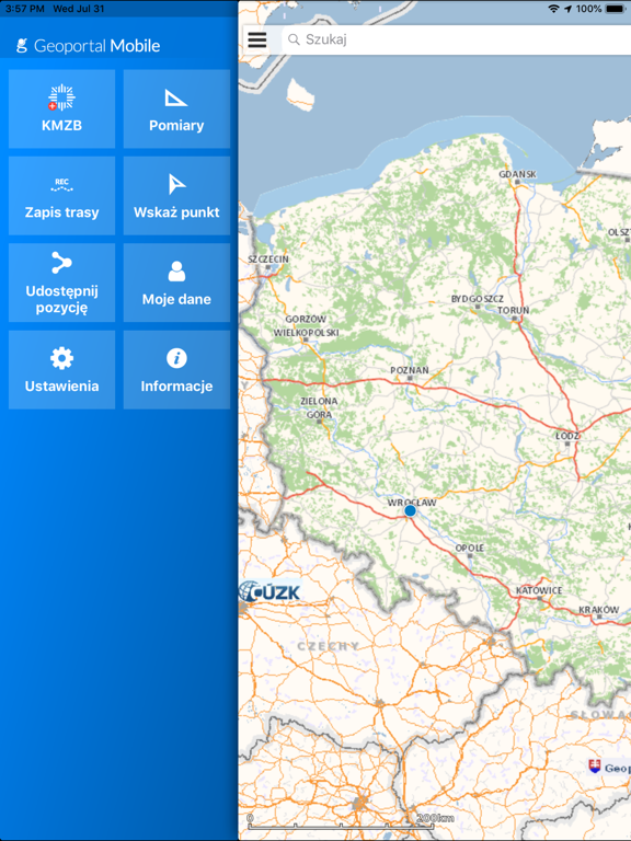
Geoportal Mobile
iOS Universel / Navigation
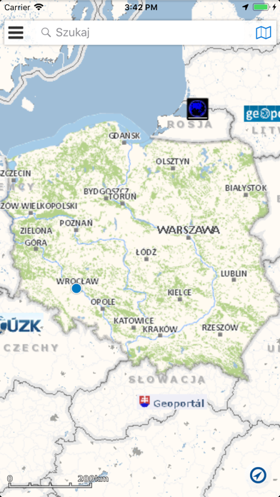
Aplikacja Geoportal Mobile zapewnia dostęp do usług danych przestrzennych OGC i GeoServices REST.
Geoportal Mobile zapewnia dostęp do rejestrów państwowych udostępnianych przez Główny Urząd Geodezji i Kartografii za pośrednictwem usług Geoportal.gov.pl.
Aplikacja umożliwia:
• dostęp do usług zbiorów danych przestrzennych,
• wyszukiwanie i lokalizację działek ewidencyjnych,
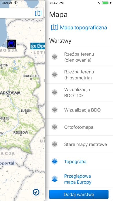
• dodawanie usług, wybór kompozycji mapowych,
• wyszukiwanie obiektów geograficznych, w tym adresów.
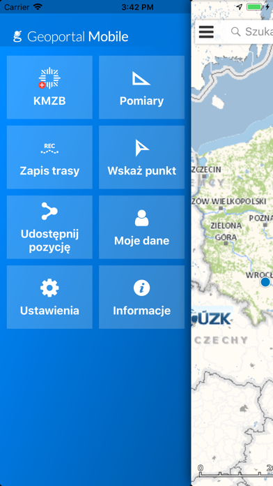
Aplikacja umożliwia użytkownikowi przeglądanie kompozycji mapowych oraz dostarcza następujące funkcje:
• In Case of Emergency (ICE pol. w nagłym wypadku) - pozwala użytkownikowi wysłać SMS z powiadomieniem o nagłym wypadku do wybranej osoby,
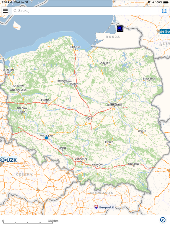
• Nawigacja w oknie mapy – zasięg mapy zostanie zmieniony (przesunięty, zwiększony, zmniejszony) zgodnie z działaniem wykonanym przez użytkownika,
• Przeglądanie usług kafelkowanych – wyświetlona zostaje mapa zawierająca treść udostępnianą przez kafelkowane usługi danych przestrzennych,
• Dodawanie zewnętrznych usług WMS – usługa umożliwia rozszerzenie kompozycji mapowych o usługi WMS rejestru usług systemu,
• Wyszukiwanie adresów, działek oraz punktów osnowy – wyszukane obiekty mogą zostać zlokalizowane w oknie mapy,
• Pomiar długości linii rysowanej na mapie,
• Pomiar powierzchni i obwodu poligonu narysowanego na mapie,
• Udostępnij lokalizację – umożliwia użytkownikowi udostępnianie aktualnej pozycji lub wybranej lokalizacji jako link do aplikacji wyświetlającego wskazane współrzedne na mapie,
• Rejestrowanie i zapisywanie trasy – umożliwia użytkownikowi rejestrację i śledzenie własnej trasy na mapie na podstawie sygnału GPS, a także jej zapisanie, wyświetlanie oraz wysłanie w formacie KML,
• Wskazywanie punktu na mapie – wskazuje lokalizację na podstawie współrzędnych e w wybranym odwzorowaniu,
• Identyfikacja adresów, miejscowości i działek – użytkownik wykorzystując gest Long Press (długie naciśnięcie) na mapie ma możliwość pobrania informacji o obiektach we wskazanym punkcie.
Uwaga:
Używanie GPS działającego w tle może znacznie zmniejszyć żywotność baterii.
Geoportal Mobile enables:
• Access to spatial data services,
• Browsing and locating cadaster parcels,
• Adding services, choice of various maps,
• Searching for geographical objects including address points.
This app enables user viewing maps and provides him the following functions:
• In Case of Emergency (ICE) – allows the user to send an SMS with the notification of an emergency to a selected person
• Map window navigation – changing map extent based on users action (pan, zoom in, zoom out)
• Viewing tiled services – displaying maps showing their contents as map tiled services,
• Adding external WMS services – this service allows user to add map content by adding WMS services.
• Searching for address, parcels, geodesy groundwork points – a chosen address or parcel will be displayed in map window.
• Measure length – measures the length of a line drawn on map,
• Measure area – enables measurement of area or outline of a drawn polygon,
• Current location – allows user to share his current position or the selected location as the link to the application displaying coordinates on the map,
• Registering and saving track – enables user registering and tracking his own track on a map based on GPS signal.
• Recording and saving route - user can record and track his own route on the map based on the GPS signal, as well as save it, display in application, and send as KML file,
• Display point on the map - points to the location on a map based on coordinates in the selected mapping,
• Identification of addresses, localities, and parcels - using gesture Long Press (long press) on the map, you can download information about the objects in the specified point.
Disclaimer:
Continued use of GPS running in the background can dramatically decrease battery life.
Quoi de neuf dans la dernière version ?
Fixed some bugs