Hikers Assistant Plus
iOS Universel / Navigation
Hikers Assistant Plus is an indispensable tool for hikes, treks, and other outdoor activities. Prepare for your outing by creating or importing routes, waypoints and base maps. On trail create a track, add waypoints, view progress and maps, check weather, and use other tools to stay on your route.
No subscriptions and no in-app purchases are required.
KEY FEATURES
Create routes on maps in Hikers Assist+ (iPad recommended). Import routes via standard GPX files from the Internet. Or collect GPS tracks while on the trail and then convert them to routes for you or your friends.
If you’ve loaded tracks, routes, and/or waypoints (we call that trail data), you can get the distance/bearing to the nearest point on the trail at any time or the distance/bearing to any of your waypoints.
If you are confused by intersecting trails, you can put the map into user tracking mode and orient your iPhone along either trail to determine your correct route.
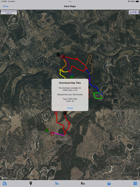
Maps can be downloaded for offline use on trails without cellular access from USGS and other Internet open source map servers. We do not provide our own map servers. Thus all downloaded maps are free of charge.
The app is designed for optimum performance and ease-of-use as a combined phone/watch pair, although the iPhone app alone provides full functionality.
Quick trail (GPS tracking), quick pedometer, and ‘as needed’ modes on both the iPhone and watch let you record tracks and records of your hikes with whatever level of power usage you desire.
Tracks being recorded are instantaneously available on your maps. You will never get lost (even if you get off your trail), and you can always find your way back to the trailhead.
Dual off-trail (route planning and analysis) and on-trail home pages optimize the process of trek planning, creating routes, and safely executing the hike!
The on-trail home page uses large, easily seen buttons to execute modules that include GPS tracking, pedometer logging, maps, elevation profiles, distances and bearings to waypoints, creating new waypoints, a compass, getting elevation, sunrise/sunset/moon-phase, weather forecasts, and viewing park maps.
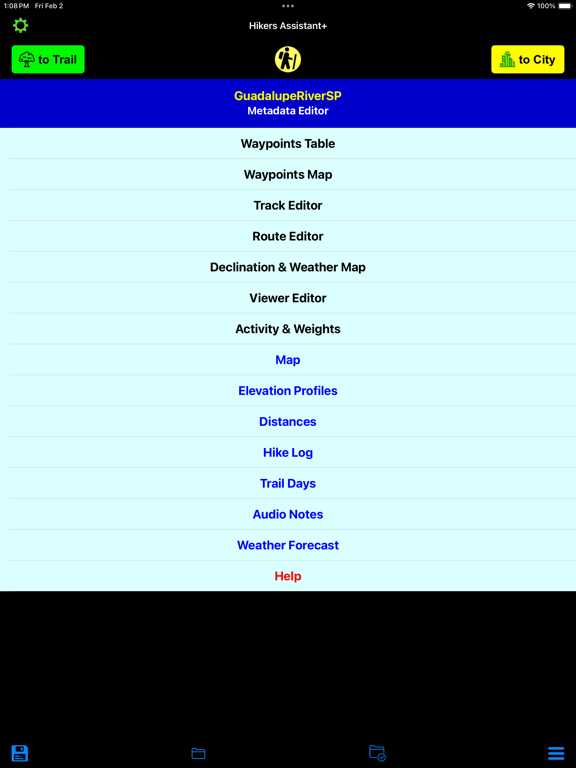
Off-trail, pre-hike planning provides you track, route and waypoint editors, maps where you can create routes, elevation profiles, and an extensive help system. Post trail, you can analyze your performance via hike and daily motion logs that show time on trail, speed, distance, steps, floors-up/down, calories burned, and battery used.
Trail data (tracks, routes, waypoints) can be saved in binary format both locally on the device or in iCloud. You can import park maps in PNG, JPG or PDF formats. You can share or import GPS trail data in standard GPX files. If you have trail files from the old Hikers Assistant, you can simply import those via iOS sharing.
The watch app allows you to monitor your iPhone’s GPS tracking progress, create its own quick GPS trail, log its own quick pedometer-based hike, or just use trail data as needed to find the nearest point on the trail or the distance/bearing to nearby waypoints. You can also monitor your hike, run, cycle, or paddle as a workout. In most situations, you can leave your iPhone in your pocket or pack.
The synergy between iPhone and watch apps let you choose the best solution in terms of power usage and convenience to meet all your hiking needs.
OTHER IMPORTANT INFORMATION
For on-trail use, your iOS device needs cellular/GPS capability. Trip planning can be completed on a WiFi-only device, with trail files emailed or transferred via iCloud to your on-trail device.
Offline map downloads rely primarily on USGS servers. Some offline maps support only US regions.
CAUTION: USGS occasionally changes their map server URL's and configurations. This may prevent some offline downloads until the next app update.
Continued use of GPS running in the background can dramatically decrease battery life.
Quoi de neuf dans la dernière version ?
- The on-trail module can now be run in City (streets with internet) and Trail (wilderness with no internet) modes selectable from large buttons on the Home Screen.
- The on-trail progress bar was extended to show both pedometer and GPS data, depending on hike type.
- On-trail buttons (tasks) were completely overhauled. The lock button again is a simple lock/unlock. The lock progress subsystem was removed, including the As Needed hike option. All actions were meant to simplify tasks and make them easier to accomplish outdoors.
- A new trail info button (task) was added to show you altitude, closest waypoint, closest trail, sunrise/sunset, and moon phase. This replaces several previous buttons.
- The compass button is now active--it points to north on a one-second repeating timer. Likewise, the waypoint distances now include active pointers (mini-compasses) so you can avoid opening the full compass if an accurate site-line is not needed.
- Five new on-trail add-waypoint buttons were added. Most require only one touch in an icon selector to be complete. The other requires a couple of touches to record audio for an audio waypoint. Four of the buttons show you common subsets of possible icons: trail, city, site, and animal.
- The on-trail weather forecast shows only key data, in larger text, to make it easier to read outside.
Nearly all on-trail buttons and text have been enlarged and modified to show high contrast colors to make their use outdoors easier.
- The off-trail module for trip preparation was also improved. A new create and edit route subsystem was added to both the off-trail map and the route editor. A similar edit track subsystem was added to the track editor. The system is vastly improved over the prior implementation.
- A declination and weather map have been added to support larger trail systems. You can load multiple declinations or weather forecasts for different localities.
- An activity & weights screen was added to allow easy changing of the activity type (hike, run, cycle, or paddle) before you get on-trail. Both user and pack weights can be easily changed. Both activity and weights are factors used to calculate on-trail calories.
- The daily motion log was removed, and a trail days log was added. Each trail day covers from the first time you go on-trail on a day till the last time you leave the on-trail module on that same day. This was intended to show your activity on multi-day hikes when you don’t want to use battery for Add Track, Quick Trail, or Quick PED.
- A waypoint media property was added that can point to image, PDF, or audio files. The on-trail map’s waypoint popup was improved to include a play/show button for media.
- Numerous minor improvements and bug fixes were also made.