Lido mPilot
iPad / Navigation
----- FOR AIRLINE USE ONLY -----
----- Overview -----
This all-in-one navigation application offers easy access to your terminal charts and a dynamically generated enroute map, as well as your operational documents. Optimized for airline use, Lido mPilot is designed to improve the pilots’ situational awareness so that they can focus on what truly matters: safe and efficient aircraft operations. Our tablet solution is designed to support modern airline workflows.
Lido mPilot comes with the aeronautical terminal charts for Zurich, Switzerland. Additional airports can only be downloaded and viewed by employees of an airline who have a Lido mPilot contract with Lufthansa Systems.
The Lido RouteManual terminal charts, used by more than 100 airlines worldwide and the basis of Lido mPilot, are meticulously crafted to display aeronautical procedures and information intuitively. The charts are in high contrast color designed specifically for use on electronic displays. Moreover, they can be tailor-made based on the specific operational requirements of your airline.
----- App Features -----
- Flight Folder to manage an entire flight
- Automatic loading of ATC flight routes
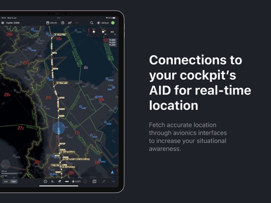
- Dynamic Enroute Map
- Airport Moving Map
- Own ship position on Enroute charts
- Static terminal charts
- Web-based document management
- Automatic data synchronization
- Chart annotations
- Sharing flight plan and charts
- Charts & Enroute Map based on appearance settings of the device
- Integrations with other Lido Products & third party vendors
Contact Lufthansa Systems from our official website to receive an evaluation chart library if you want to know more.
Quoi de neuf dans la dernière version ?
The Lido mPilot 7.0.20 release delivers important fixes and usability improvements designed to enhance flight operations and ensure greater reliability.
Key fixes and enhancements include:
- Improved module switching between AMM and SID.
- Handling of effective dates in the Terminal module, regardless of device date-time settings.
- Capability to close all taxiways (TWYs) in AMM.


