SmartSky Pro
iPad / Navigation
SmartSky Pro is an EFB application that provides the user with a set of functionality for working with aeronautical information, flight tasks and ship documentation and helps to get rid of a large amount of paper documentation.
The application has been on the market since 2013.
MAIN FEATURES
The structure of the airspace is displayed in accordance with the current restrictions in real time.
There is a choice of metric or imperial units of measurement.
Day and night mode.
Available to search for objects in the database.
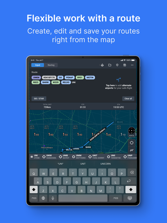
The route is displayed on the map. The route can be entered manually, entered from the map and imported in ATC FPL format. The route includes alternate aerodromes and SID/STAR/APRROACH procedures.
The track is recorded in gpx format.
It is possible to measure the distance on the map using a ruler or radial rings.
Implemented display of NOTAM and meteorological information.
Terrain available.
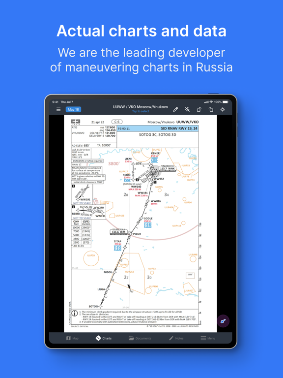
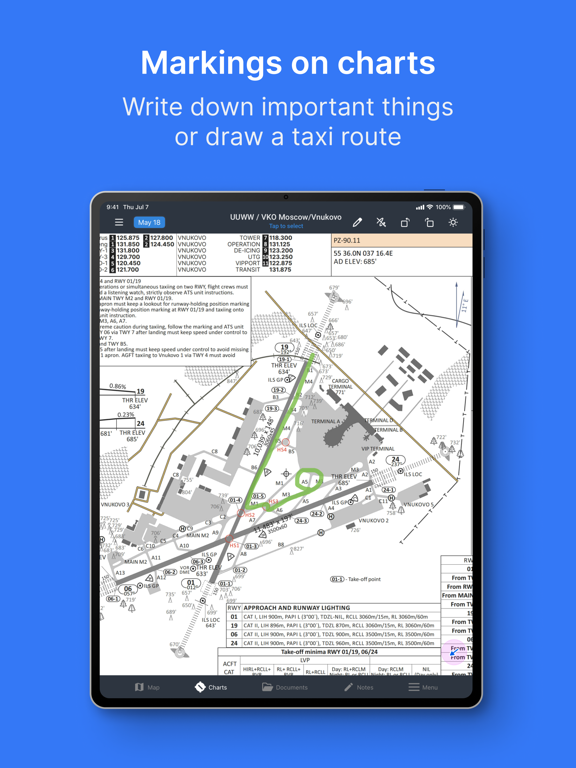
Airport and heliport schemes are available with the ability to leave notes on them, view NOTAM and meteorological information on them, as well as display georeferenced schemes on the map. It is possible to create custom schema packages.
It is possible to download and display ship documentation.
Data is kept up to date and updated according to AIRAC cycles, and unscheduled updates are also available.
Thanks to all users who took the time to report bugs and feature requests.
Stay in touch. Questions, feedback or ideas? Write to us at support@szrcai.ru
Our website: https://www.szrcai.ru/
Our Youtube channel: https://www.youtube.com/@SzrcaiRu
User manual: https://www.szrcai.ru/page/smartsky
Privacy policy: https://www.szrcai.ru/page/policy
Quoi de neuf dans la dernière version ?
- Added a GPS-free flight mode (Dead Reckoning) — dead-reckoning navigation for GPS signal loss or spoofing: manual switch to dead reckoning, and a control panel for aircraft position and flight parameters.
- Implemented the SIGMET/AIRMET hazardous weather map: zone display on the map, a weather control panel on the Map screen, smooth zone movement animation over time, and a real-time display mode.
- Navlog: implemented table customization — tap a column header to replace it with another parameter, and drag columns to arrange them in a convenient order.
- Added a navigation parameters box and abeam point passing time calculation.
- Added the "Right-seat interface" option in the Charts section — the side panel can be placed on the right side for the right-seat pilot.
- Improved the Track Vector feature based on user feedback, including a turn behavior setting.
- Documents: added section-wide search and improved tab handling.