Outcrop
iOS Universel / Productivité
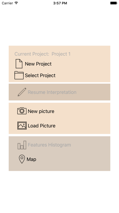
This application is designed for the geologist to use during field studies. It lets the user take pictures of the outcrop, interpret the high resolution image and export this information in 3D to construct a 3D geological model.
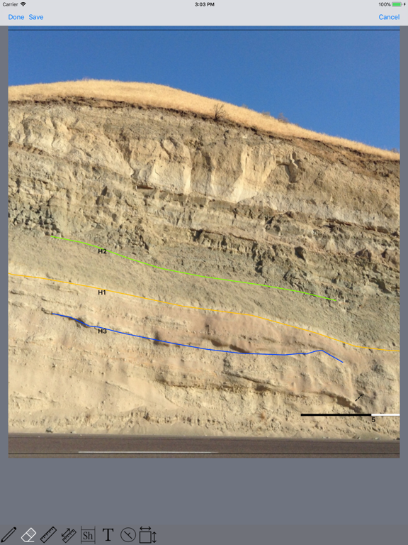
On the image, the user can interpret facies intervals, sedimentary structures and boundaries. The user can add annotations anywhere, measure width/height of sediment bodies (channels, lobes, etc.), and compute bodies statistics.
Using an iphone or ipad, the user can measure dip and azimuth and locate this measure on the picture or use its GPS location to export dip markers to the 3D model.
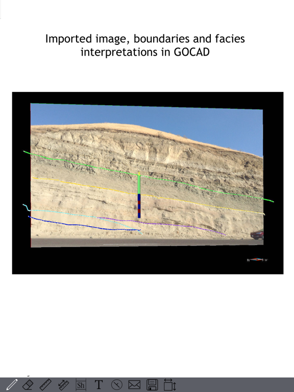
Once the user defines the image scale, all interpreted boundaries and intervals can be exported in 3D in GOCAD format (image, interpretations boundaries, dip/azimuth and facies intervals).
Quoi de neuf dans la dernière version ?
This update from Apple will improve the functionality of this app. No new features are included.
This release provides bug fixes and some enhancements.
The main enhancement makes use of the IOS 11 new Files App to facilitate exports of GOCAD model files. Files can now be exported directly to the Files App. This new option can be found in the Save interpretation popup.
Additional enhancements have been made to the Image selector, to the labeling of boundaries in the Interpretation View, to the interpretation toolbar and to the process of measuring dimension of bodies.
The main bug fix was about the display of facies pixmap.