Map Marker: places organizer
iOS Universel / Utilitaires
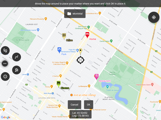
This app uses Google Maps and other sources in order to allow you to place markers even without internet connection.
If you have any issues with the app, please contact me by email, I will most likely be able to help.
Features:
• Set a title, a description, a date, a color, an icon and pictures for each marker, and move them freely on the map
• Organise your markers into different folders
• Browse and organize your markers easily from the text-searchable markers list
• Search places from various sources and create a new marker from the result
• Open a marker's location in any other map application already installed
• Navigate to a marker's location with the integrated compass
• Display and copy marker GPS coordinates to clipboard with one click
• Display a marker's address if available
• Create path-markers and measure their distance easily
• Create polygon-surface-markers and measure their perimeter and area easily
• Create circle-surface-markers and measure perimeter and area easily
• Create GPS tracks recorded from your device location
• Share a captured image of the current map
• Share markers as KML files
• Import markers from a QR code
• Import/export markers from/to KML or KMZ files
• Import your Google Maps favorite locations (those marked with a star)
• Exported KML files are compatible with most other map softwares such as Google Earth
• Custom fields for markers: Checkbox, Date, Email, Text, Multi-choice, Phone, Web link
• Create templates for custom fields per folder: the child markers will inherit their parent folder's custom fields
Premium features:
• Save your markers on the cloud with WebDAV, Google Drive or Dropbox
• Collaborate with your friends by sharing your map cloud folder with them: anyone with access to the map folder can modify it and changes will be synced to everyone using the folder
• Restore previous versions of your cloud map folder
• One time purchase for a lifetime upgrade on your Apple account with an unlimited number of iOS devices
• No ads
Used permissions:
• Get your location => to locate you on the map
• Access to external storage => to export, save and import to/from files
Quoi de neuf dans la dernière version ?
* Updated the search UX to use the main map
* Improved UI smoothness while syncing
* Upgraded Flutter version to 3.38.3
* Fixed layout issues with system bars
* Fixed incoming share actions not working on iOS 18
* Fixed track recording location updates pausing when in background on iOS 26
* Improved views layout orchestration
* Applied smart number-aware sorting to folders
* Fixed opacity animations slowing down if interacting with the map view
* Fixed image file import errors being silent, now shows an error message


