mapryForest
iOS Universel / Utilitaires
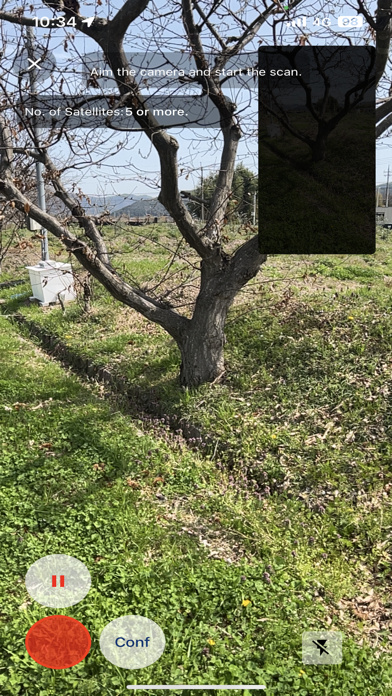
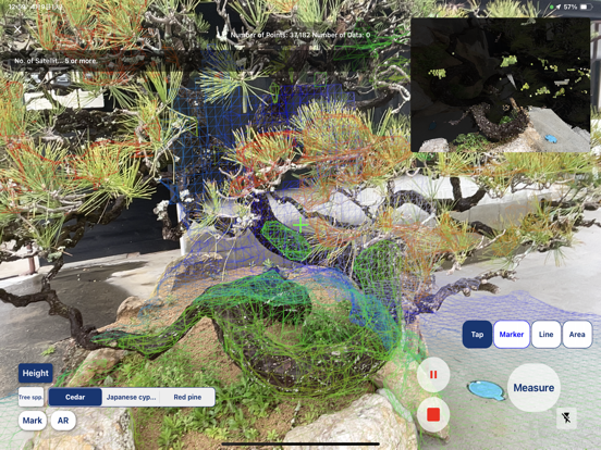
mapryForest is an application that can save and display point clouds taken with the 3D scanner function.
While using the 3D scanner function, you can acquire single-tree information such as diameter and longitude/latitude of a single tree by tapping the + icon on a single tree.
The acquired point cloud and single tree information can be saved and displayed.
■mapry
https://apps.apple.com/jp/app/mapry/id1394357769
■Web version
https://mapry.net
En voir plus...
Quoi de neuf dans la dernière version ?
・投稿、タイムライン機能の削除