RTAB-Map - 3D LiDAR Scanner
iOS Universel / Utilitaires
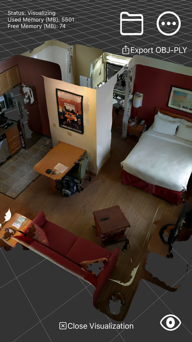
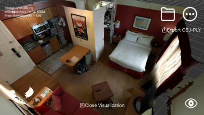
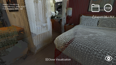
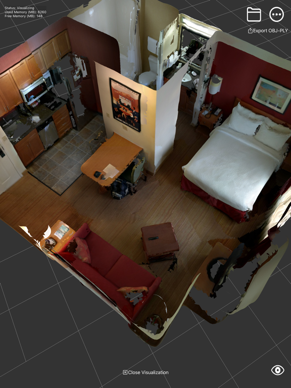
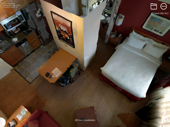
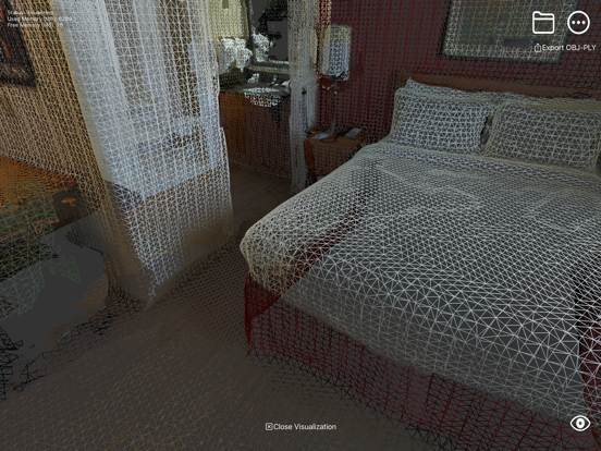
RTAB-Map (Real-Time Appearance-Based Mapping) is an Open Source LiDAR / RGB-D / Stereo Graph-Based SLAM (Simultaneous Localization and Mapping) approach based on an online incremental appearance-based loop closure detector. The loop closure detector uses a bag-of-words approach to determinate how likely a new image comes from a previous location or a new location. When a loop closure hypothesis is accepted, a new constraint is added to the map's graph, then a graph optimizer minimizes the errors in the map in real-time. An optional memory management approach can be used to limit the number of locations used for loop closure detection and graph optimization, so that real-time constraints on large-scale environnements are always respected. ARKit's visual inertial odometry (VIO) is used as the SLAM front-end for RTAB-Map (the SLAM back-end).
* Note that unlike other scanning apps that optimize the map only after mapping, with RTAB-Map you get loop closure detection and map optimization online so you can have a live feedback to know when you have enough constraints in the map for good global optimization before stopping the scan.
*** 3D reconstruction available only with LiDAR sensor.
Features:
* Online 3D scanning/mapping of the environment.
* Online loop closure detection and map correction.
* Save in DB format (RTAB-Map desktop and rtabmap_ros format).
* Export in PLY, LAS or OBJ.
* Multi-session mapping (save and continue later).
* Use Apriltags to help finding loop closures in textureless environments.
* Mixed AR/VR First-Person in visualization mode.
* Raw ARKit data recording (up to 60 Hz!), useful to record long sessions without comprising battery life.
Quoi de neuf dans la dernière version ?
Same as 0.22.0, re-uploaded for App Store's Age Ratings policy updates.