San Juan Islands (Washington)
iOS Universel / Voyages
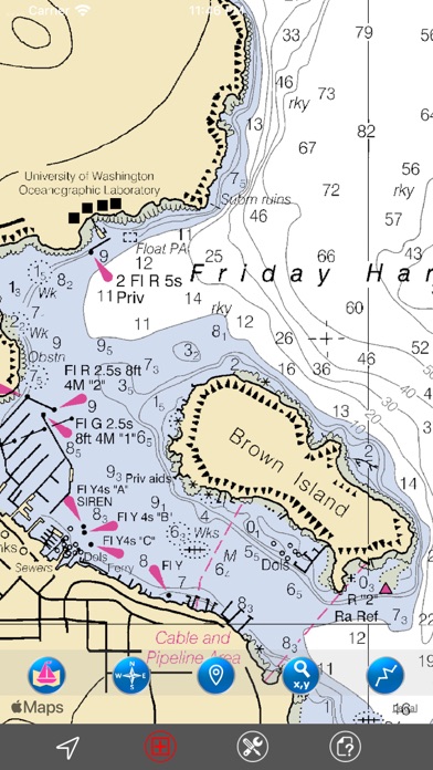
THE ALL NEW ADVANCED MARINE RASTER NAUTICAL CHARTS APP FOR BOATERS, SAILORS, KAYAKERS & CANOERS!
COMBINATION OF SMALL CRAFT AND HARBOR CHARTS FOR EASY NAVIGATION.
ALL CHARTS OVERLAY IS ARRANGED IN A SEAMLESS ORDER, BASED ON CHART SCALE AND PRIORITY.
NO NEED TO CHANGE CHARTS MANUALLY, THEY ARE READY FOR CONTINUOUS NAVIGATION.
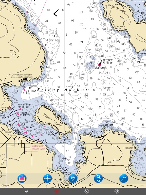
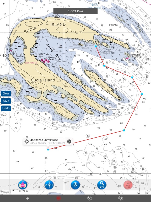
- ALL SAN JUAN ISLANDS (WASHINGTON) NAUTICAL CHARTS ARE FROM NOAA SOURCES.
- ALL CHARTS ALIGNED WITH ORIGINAL CHART CO-ORDINATES, ARE ACCURATE FOR USE.
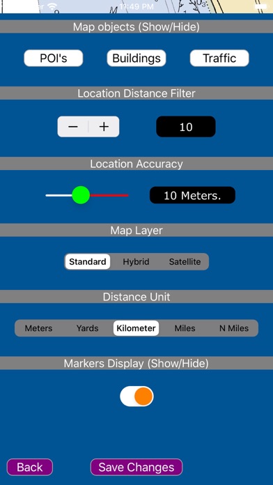
- TRACK YOUR LOCATION WITH GPS ON MAP.
- OFFLINE CHART OVERLAY DISPLAY, USE THEM AS LONG AS YOU SAIL.
- HIDE AND SHOW CHART OVERLAY TO SEE DIFFERENCE IN SATELLITE OR OTHER MAPS.
- USER-INTERACTIVE COMPASS FOR DIRECTIONS (TRUE/MAGNETIC).
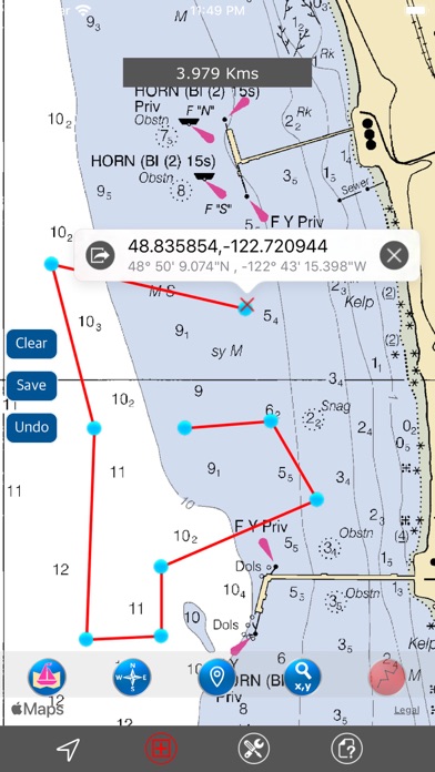
- INSERT UNLIMITED FAVORITE MARKERS ON MAP. PHOTO TAGGED FACILITY FOR MARKERS WITH EMAIL OPTION.
- FIND DISTANCES WITH ROUTE TOOL, DRAW ON MAP AND NAVIGATE ALONG THE ROUTE. SAVE, LOAD & EMAIL AS KMZ.
- USER FRIENDLY SETTINGS TO CONTROL MAP FEATURES.
THIS APP IS MOST ADVANCED WITH ALL THE NECESSARY TOOLS FOR EASY NAVIGATION ON WATER. CONTINUOUS CHARTS DISPLAY MAKES IT MORE EASIER FOR SAILING AND AS THERE WILL BE NO INTERNET ON SEA, THE OFFLINE CHART DISPLAY WILL BE HELPFUL FOR EASY NAVIGATION.
NOTE: All charts are Geo-positioned to match the exact location of features displayed on charts but there may be some difference between the positions of actual objects that are in the water or sea and nautical charts shown on map because of the different chart scales.
We strive to provide the best quality products to the boaters/sailors. We welcome suggestions from the users of this product to improve and make the map more useful.
HAPPY BOATING AND SAILING ALL THE TIME!
Quoi de neuf dans la dernière version ?
- Compatible to iOS 13.
- Optimised Nautical Charts Viewer.
- Interactive Map Settings.
- Store & Email Way Points.
- Updated Charts.
- Performance Improvements & Bugs fixed.